Article
Calle Cañete: living in the historic heart of El Carmen
A quiet dead-end street off Carrer de Quart, on record since 1600, in one of the oldest corners of Valencia.
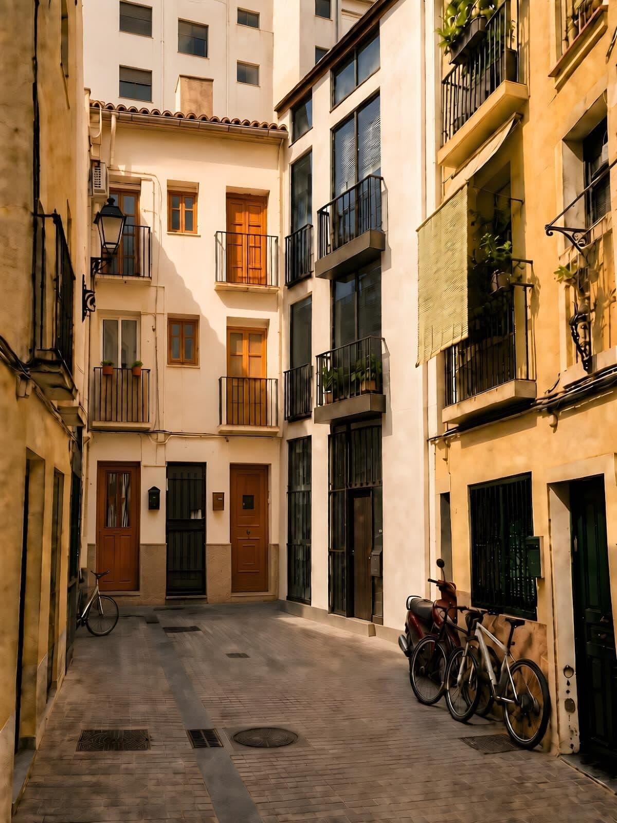
Render: Revivo Development
Calle Cañete is about seventy meters long. It leaves calle Quart just behind the towers, runs between narrow façades and stops against the wall at the end: there is no way out. Nobody passes through it. You go in and you come back.
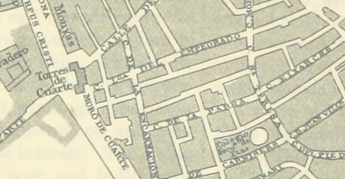
Plan of Valencia from O’Shea’s Guide (1895), showing the Torres and Muro de Cuarte, a three-minute walk from calle Cañete.
O’Shea’s Guide to Spain and Portugal, J. Bartholomew, Edinr., engraver (1895). Wikimedia Commons (British Library, Mechanical Curator collection). Public domain
View at full size (opens in a new tab)A row in the street register of 1873
In 1873 Manuel Carboneres published the Nomenclator de las puertas, calles y plazas de Valencia, a table in which every street takes one row of four columns: the name, where you enter, where you leave, and the names it has and has had. On page 40, between Canonge Gomis and Capellans, the row reads: Cañete, entered from Cuarte, no way out, En Bataller.1
Beside the name it prints “A. 1600”. The book’s own key explains that the A stands for the aveinaments, the registers by which the city granted residence, and that names set in bold, as this one is, are those of streets still standing when the book was made. The name is on record in 1600; before that the street was called En Bataller.1
The plot on the corner
Valentia was founded in 138 BC. The literary sources say that Junius Brutus led the expedition of discharged soldiers who settled it on an island in the Turia, not far from the sea.2
On the corner of calle Quart and calle Cañete there is a plot of some 500 square meters, dug between 1992 and 2000 by Pierre Guérin, Beatriz Arnau Davó and Elisa García-Prósper. It gave 267 funerary structures, among them 248 graves: close to 180 burials and 69 cremations.3
It is part of the necropolis of calle Quart, also called the Western Necropolis, the oldest cemetery found in the city so far, reckoned at some 5,000 square meters and lying about 500 meters outside the imperial Roman walls.2
The Quart-Cañete sector has three moments: an early Republican phase dated to the last third of the second century BC, a late Republican one of the first century BC, and an Imperial one running from the first to the third century AD.3
The first phase is the founding one
From that oldest phase, 71 burials and 12 cremations were excavated. What dates them is not an inscription but the tableware and the amphorae buried with them: transitional Greco-Italic wine amphorae, Campanian A ware, thin-walled beakers and gray jugs from the Catalan coast. Together they give a starting date in the third quarter of the second century BC, which is to say the years the city was founded.3
Among those graves are six of an uncommon kind: chamber tombs, or hypogea, a rectangular pit with a niche cut into one of its long walls, where the body lies with its grave goods. They are 3.35% of the burials excavated.3
Towards the south, towards calle Quart, the burials stop dead: the ground drops some four meters and nobody could be buried there. Towards the north, the east and the west, on the other hand, the graves carry on beyond the foundations of the buildings next door.3
People from the Abruzzi
In December 2025 the Universitat de València reported something new about those chamber tombs. The ones from calles Quart and Cañete, behind the towers, are of the type called grotticella, and they resemble nothing local. They do resemble, closely, those of the necropolises of the towns around Corfinio, in L’Aquila, once the capital of the Peligni, a people of central Italy.4
From which it follows that among the first inhabitants of Valentia there were people who had come from there. The work is by Albert Ribera, of the Institut Català d’Arqueologia Clàssica, with David Quixal and Iván Fumadó, of the department of Prehistòria, Arqueologia i Història Antiga of the Universitat de València.4
It was presented at the international congress La fundación de Valentia y el final de los pueblos itálicos e ibéricos, held on 13 and 14 November 2025 at the Facultat de Geografia i Història of the Universitat de València.5
In other words, where part of the city’s founders came from is known from how they buried their dead, and those graves are in the plot on the corner of calle Quart and calle Cañete.3
Where the name comes from, that we do not know
Carboneres records when a name appears and which names came before it, not why it was chosen. We also looked in Pascual Madoz’s Diccionario geográfico-estadístico-histórico, whose volume XV, of 1849, describes Valencia at length: no calle Cañete appears in it, and no En Bataller either.1, 6
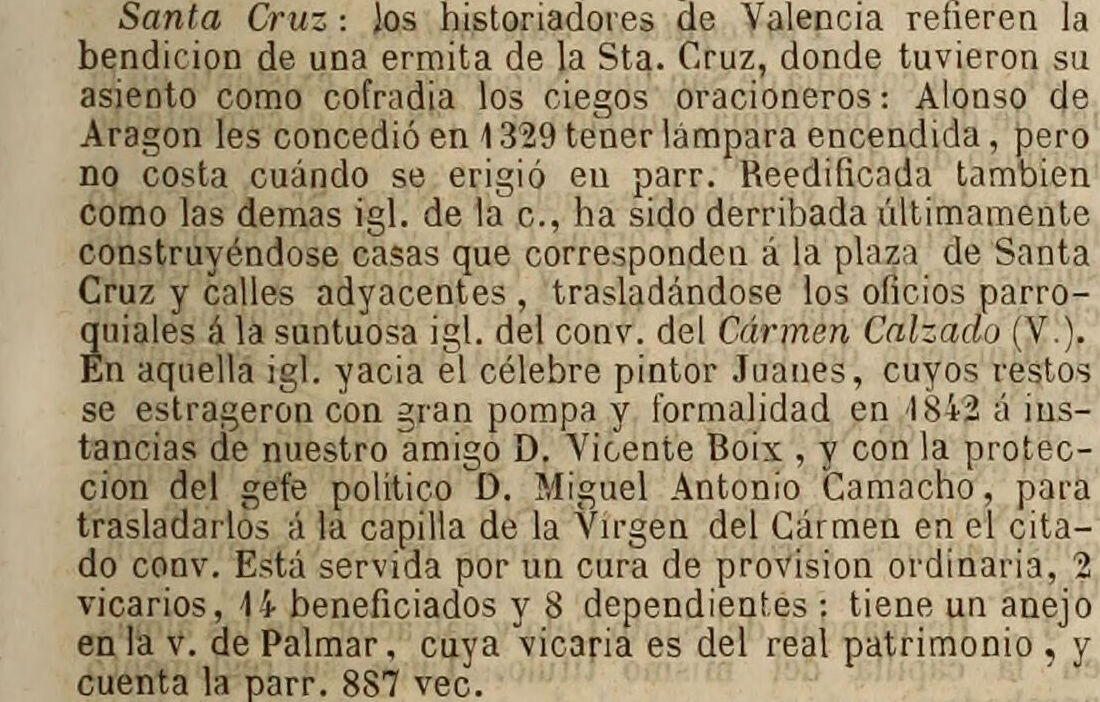

Madoz, volume XV, 1849, p. 379. Calle Cañete does not appear.
Diccionario geográfico-estadístico-histórico de España y sus posesiones de ultramar, tomo XV, Pascual Madoz (1849). Internet Archive. Public domain
View at full size (opens in a new tab)Explanations circulate online, but none comes with a document anyone can check, so we do not repeat them. Nor do we say what lies under each doorway: what was dug is the plot on the corner, and the sources speak of it and of the two streets.
Building on top
We are building at number 18. The block sits inside the walled enclosure, the first of the three areas by which the decree of 1993 delimits the historic ensemble of Valencia, declared an asset of cultural interest.7
The excavation at number 18
In Ciutat Vella the ground is looked at before it is touched. The Valencian cultural heritage act, 4/1998, requires whoever promotes works that move earth in an area of archaeological vigilance to file a prior study signed by a competent technician. On the strength of that study the administration decides whether an archaeological intervention is needed before work starts, and that intervention is at the developer’s expense.8
At number 18 it was done. Between October and December 2025, the archaeology team dug a little over a meter below ground and found an unbroken sequence from the twelfth century to today. The oldest of it is garden plots from the Almohad period, outside the Islamic wall, dated by the pottery: a small sgraffito jug and turquoise-glazed pieces.
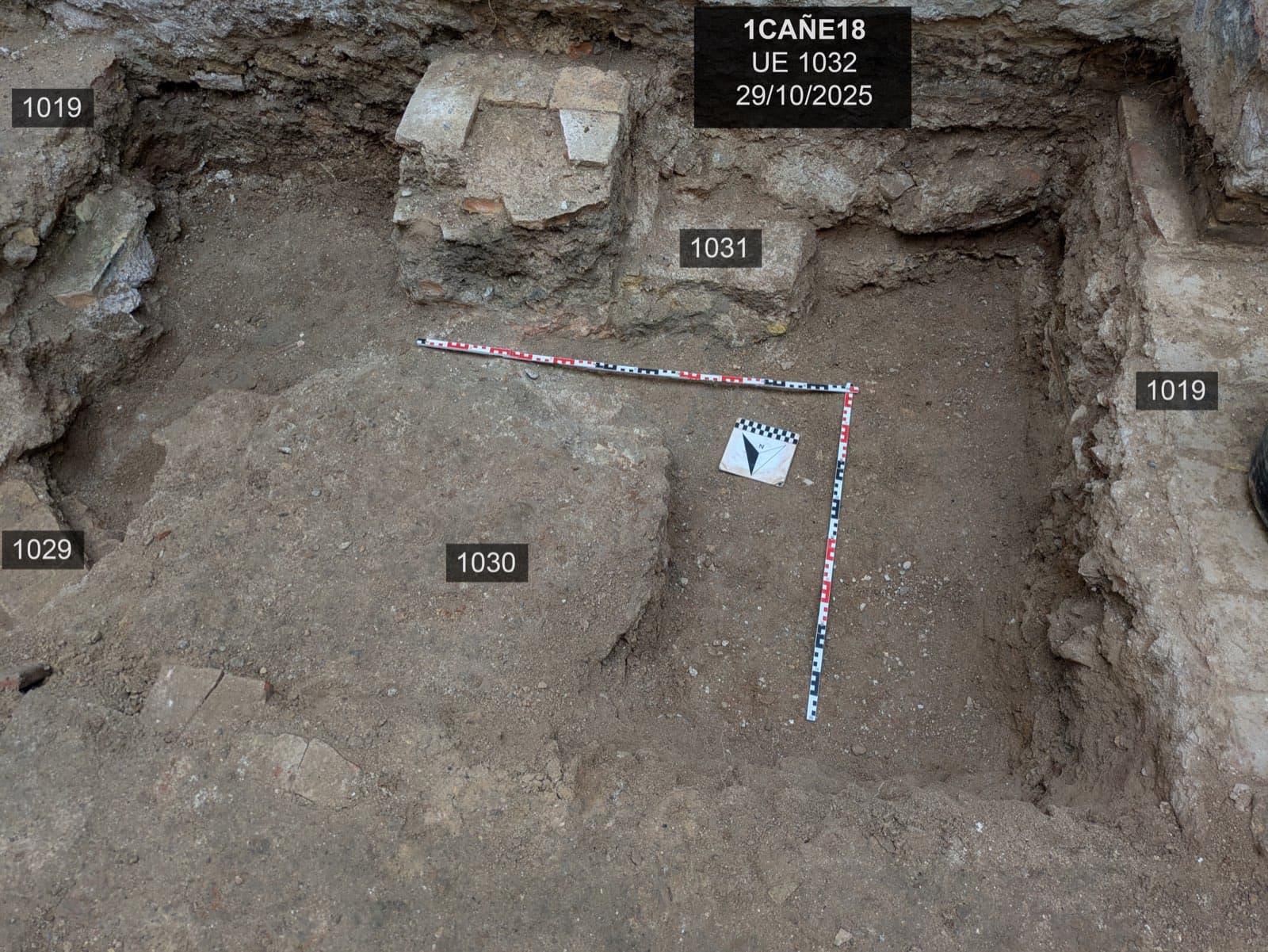
Almohad level, twelfth–thirteenth centuries
Photograph: Revivo Development
Above that came a building from the late Middle Ages, with floors, a well and drains, and foundations from the fifteenth or sixteenth century built with reused stone, among it the broken base of a column. There was also a circular structure two meters across, lined with red brick, probably the base of a wine press.
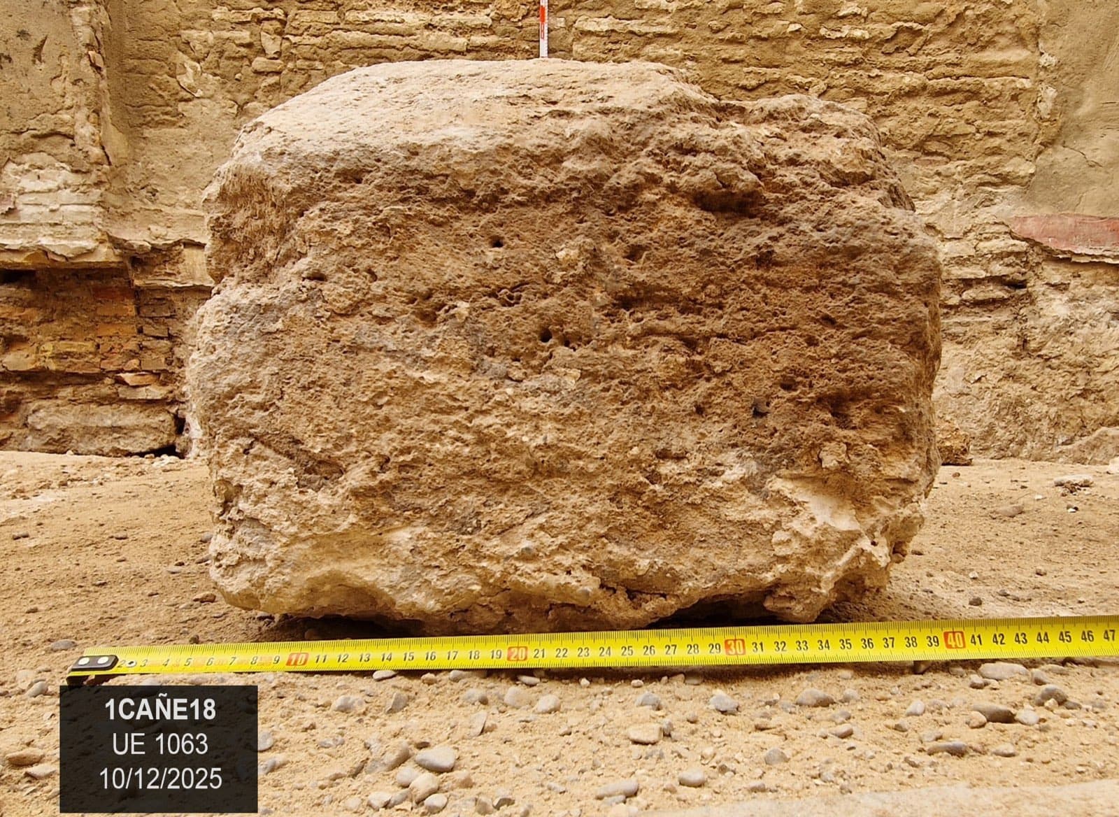
Reused column base
Photograph: Revivo Development
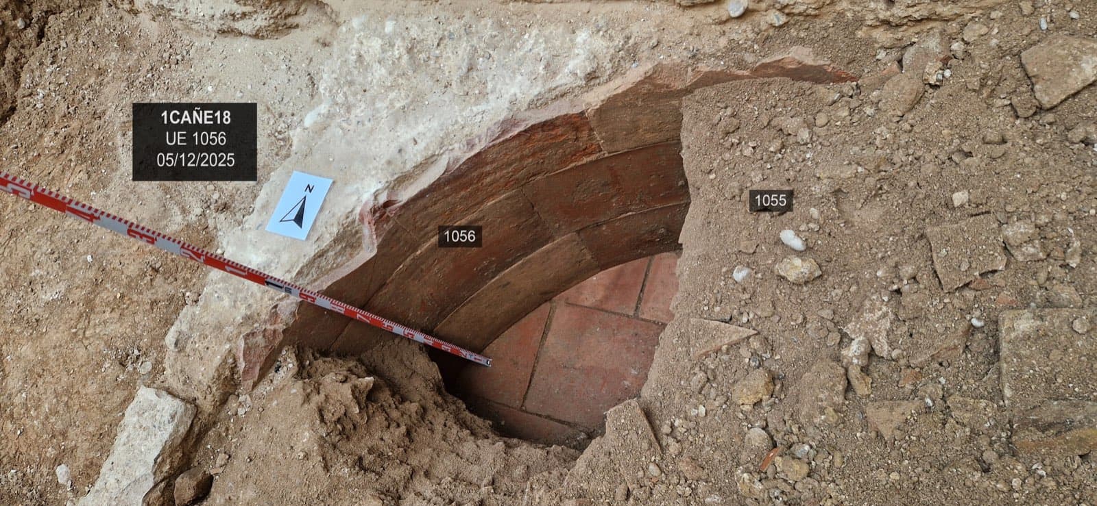
Base of the wine press, fourteenth–sixteenth centuries
Photograph: Revivo Development
The remains suggest wine, vinegar or spirits were made here between the fourteenth and sixteenth centuries, though the reading is preliminary and the dates may be adjusted once the materials are studied. The wine press, the foundations and the well stay protected under the new building. Nothing Roman turned up, but the dig did not reach that depth either: it stopped at the Almohad level, a little over a meter down, above where the Roman remains would be.
Sources
Everything this article states comes from one of these. The numbers in the text lead to the one it came from.
- 1
Nomenclator de las puertas, calles y plazas de Valencia: con los nombres que hoy tienen y los que han tenido desde el siglo XIV hasta el día (Manuel Carboneres, 1873), p. 40. Imprenta del Avisador Valenciano, Valencia. Copy held by the Biblioteca Valenciana, digitized in BIVALDI, Public Domain Mark.
Read on 23 September 2026
The row for calle Cañete, the earlier name En Bataller, and what the abbreviation “A.” and the bold type mean, from the book’s own key.
- 2
La fundación de Valentia y sus primeros pobladores. Primeras evidencias osteoarqueológicas de tuberculosis en Hispania (Manuel Polo Cerdá, Elisa García Prósper, Pierre Guérin y José Delfín Villalaín Blanco, 2004), pp. 292–305. Zona Arqueológica, miscelánea en homenaje a Emiliano Aguirre. Copy on the website of the Paleolab group at the Universitat de València.
Read on 23 September 2026
The foundation in 138 BC and the expedition of Junius Brutus, the estimated extent of the necropolis and its distance from the imperial Roman walls.
- 3
Los ritos funerarios de la necrópolis romana de la calle Quart de Valencia (siglos II a. C. - III d. C.), tesis doctoral de Elisa García Prósper, 2016. Universitat de València. Full text in RODERIC.
Read on 23 September 2026
The plot on the corner of Quart and Cañete, who dug it and when, the count of structures and graves, the three phases, the material that dates the oldest of them, the six chamber tombs, and how far the burials reach. The count of burials appears twice in the thesis and does not agree, 179 in the text and 178 in the summary table, which is why the article says “close to 180”.
- 4
El tipo de entierro confirma que entre los fundadores de València había población peligna, una tribu del centro de Italia (11 de diciembre de 2025). Universitat de València.
Read on 23 September 2026
That the chamber tombs from calles Quart and Cañete are of the grotticella type, their likeness to the necropolises around Corfinio, capital of the Peligni, and who signs the work and at which institutions.
- 5
Seminario internacional La fundación de Valentia y el final de los pueblos itálicos e ibéricos, 13 y 14 de noviembre de 2025. Facultat de Geografia i Història, Universitat de València.
Read on 23 September 2026
The exact name of the congress, its dates and where it was held.
- 6
Diccionario geográfico-estadístico-histórico de España y sus posesiones de ultramar, tomo XV (Pascual Madoz, 1849), entrada «Valencia». Madrid, 1849. Copy digitized in the Internet Archive.
Read on 23 September 2026
That the work mentions neither calle Cañete nor the name En Bataller.
- 7
Decreto 57/1993, de 3 de mayo, del Gobierno valenciano, por el que se declara bien de interés cultural el Conjunto Histórico de la ciudad de Valencia. BOE núm. 214, de 7 de septiembre de 1993, pp. 26404–26414. Boletín Oficial del Estado.
Read on 23 September 2026
That the delimitation of the historic ensemble begins with the walled enclosure, the Ciutat Vella.
- 8
Ley 4/1998, de 11 de junio, del Patrimonio Cultural Valenciano, artículo 62, «Actuaciones arqueológicas o paleontológicas previas a la ejecución de obras». Consolidated text. Boletín Oficial del Estado.
Read on 25 September 2026
That the developer files a prior study where earth is moved in an area of archaeological vigilance, and that the administration decides whether a prior intervention is needed, “at the developer’s expense”.